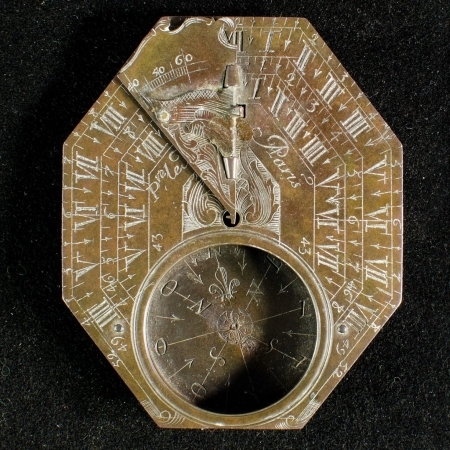
Brown County / Green Bay / Pre-1787 / Related Stories / Global Connections / Nature & Environment / Transportation & Tourism / Region 5 - Center East / Le Maire Sundial
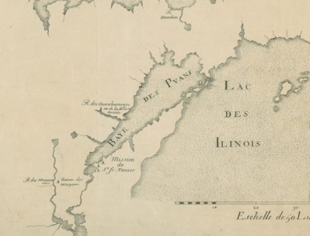
French Cartography in the Great Lakes
French mariners and explorers using the Le Maire Sundial Compass depended on both their own specialized navigational expertise and maps produced by French cartographers. Many such maps were created based on explorer accounts of the navigable waterways between the Atlantic Ocean to the Mississippi…
Comments Off on French Cartography in the Great Lakes
December 21, 2016