Fishing can take a lot of patience. A person could sit with their fishing pole for hours before they get a bite! Fishing weirs are time-saving technologies built in the water to trap fish. This fishing weir was created by the people who lived in the Early Mississippian settlement, Aztalan, sometime between the 10th and the 13th centuries.
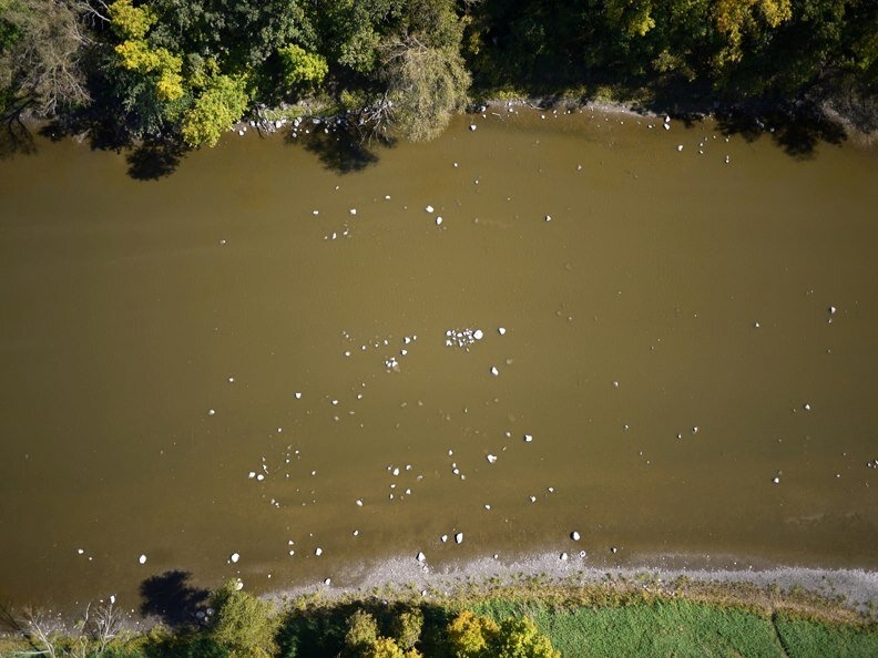
The remnants of the Aztalan fishing weir in the Crawford River, seen from above. Image courtesy of the Friends of Aztalan State Park.
This watercolor by English colonist John White depicts a composite scene of Algonquin fishing practices in the 16th century. A wooden fishing weir appears at the upper left. Image from Wikimedia Commons.
Although much of the village of Aztalan has been gone for hundreds of years, this fishing weir still remains in the Crawfish River. If you are lucky to visit when the water is low, you can still see it today! Standing on the sandy bank of the river you would see two rows of stones just below the surface of the water stretching across the river to form a “V”, with the pointed end downstream. These stones and boulders were left behind by the glaciers 10,000 years ago and were later used by the Mississippians to create their weirs. The water is able to flow around the rocks, but fish are too big and cannot pass through the rock barrier. The farther downstream the fish swim, the narrower the weir becomes. As the fish swim through the narrowest section of the weir they would be met by an unfortunate surprise!
The Mississippians would wait on the boulders near the opening with their spears, ready to strike any fish that passed through. At other times large baskets could be left just past the opening. Water would be able to pass through the basket, but the fish would not be able to escape.
Technology is more than just electronics. Fishing weirs like the one created at Aztalan are also technology. The term technology includes all kinds of tools designed to make work easier. For example, using the glacial rocks to build a weir was one method the people of Aztalan village made fishing easier and more efficient.
The village of Aztalan sits along the Crawfish River. If you visited this site 1000 years ago, you would have been in a village that looked very different from later Native American villages in Wisconsin. The village was surrounded by a stockade (a large fence made from tall logs) and contained large pyramid-shaped mounds with flat tops. Villagers lived in houses made from plant materials and clay.
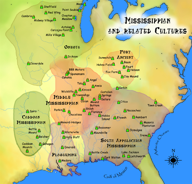
By studying the artifacts the people here left behind, archeologists know their culture and trading relationships connected to the Mississippi river system, so we say that the people who lived here were part of a Mississippian culture group. Flat-topped mounds similar to those at Aztalan can still be found throughout the Mississippi watershed as far east as Ohio and as far south as Louisiana.
One of the major power centers of the Mississippian culture was located across the river from present-day St. Louis in a city that the French named Cahokia. We don’t know the name Mississippian peoples called the city. Though we do not know very much about the full history of Cahokia, archeologists and anthropologists believe that at its height the Cahokian trading empire stretched from Georgia to Minnesota and west into Oklahoma. The city of Cahokia was abandoned around 1350, perhaps due to flooding.
Some fishing weirs are made from nets or wood, like this example from Oulu, Finland. Image from Wikimedia Commons.
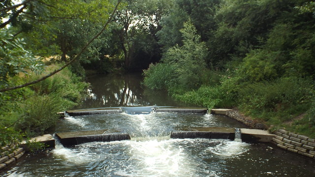
Some weirs are made from stone, like this one on the River Lea in Hertford, England or the one built at Aztalan. Image by Malc McDonald.
Mississippian culture groups often built pyramid-shaped mounds, and this map illustrates different regions of Mississippian culture groups as well as the location of some of the more famous mounds. Image from Wikimedia Commons.
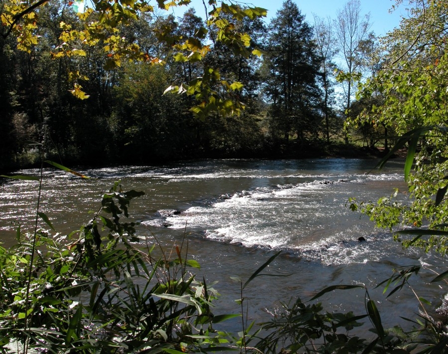
A Cherokee weir similar to the one the people of Aztalan built, showing what it looked like 1000 years ago. Image from Western Carolina University's Digital Heritage Project.
The remnants of the Aztalan fishing weir in the Crawford River, seen from above. Image courtesy of the Friends of Aztalan State Park.