OBJECT HISTORY: A Dam Tower in the Kickapoo Valley Reserve
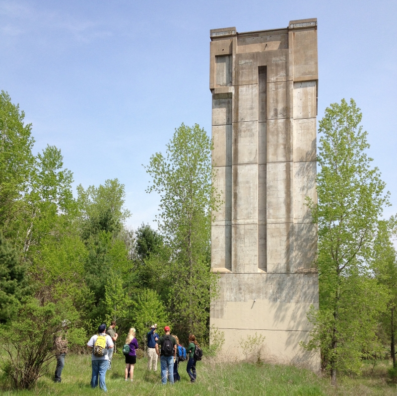
This concrete obelisk stands near the Kickapoo River and is located a mile north of the village of La Farge. It rises nearly a hundred feet above the river valley floor. The tower was constructed more than forty years ago as part of a federal flood control project. Today, it stands as a visual reminder of a contentious time in the history of the Kickapoo Valley.
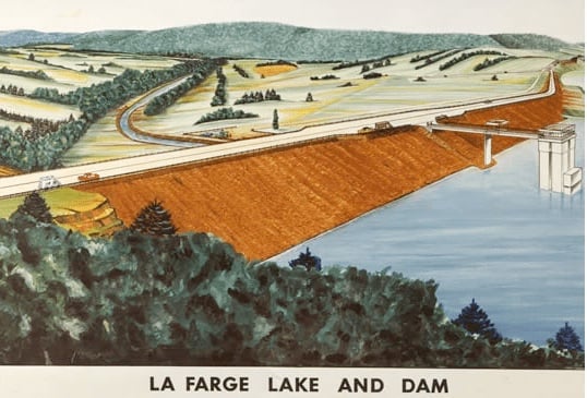
The Army Corps of Engineers constructed the tower in the early 1970’s as part of a project funded by the federal government called the La Farge Dam and Lake Project. Originally planned to protect the valley against floods, the dam project was expanded to include an 1,800-acre lake intended for recreation and tourism. The lake would be called Lake La Farge. In order to build the dam and the lake, the federal government bought nearly 9,000 acres of land in the Kickapoo Valley. Local residents did not want to sell their land to the government, and many bitterly opposed the creation of the dam. The land that Kickapoogians were forced to sell to the federal government came to be known locally as the “government land.”
This dam tower is the only part of the giant project that was ever completed. The 110-foot concrete tower was built to take water from Lake La Farge and feed it back into the Kickapoo River below the dam. Before the rest of the dam could be completed, a variety of economic, environmental, and political problems halted the project. With these setbacks, the federal government abandoned the flood control project by 1978.
But what about all that land?
For the next fifteen years, policy makers and local communities debated what to do with the government land and the partially completed dam. Some people wanted the dam to be completed for flood control with a smaller lake behind it. Others wanted the dam but did not want to create a large lake. Still another group wanted the land that had been taken for the project to be made into a national park. Locally, many Kickapoogians wanted the dam and lake project completed as originally planned.
Through all these years of discussions, the dam tower offered a visual reminder of the failed dam project. Finally, a plan was accepted to create the Kickapoo Valley Reserve from the government lands. This land was transferred from federal to state control in 1996 and a local management board was created to oversee what came to be called the Kickapoo Valley Reserve.
An illustration showing the proposed La Farge Dam with the lake behind it. The dam tower is visible on the right side of the image. Image courtesy of the Kickapoo Valley Reserve.
As part of the process to transfer the government land to the state, the Army Corps of Engineers decided that the water intake tower should be demolished. With several open gates, doors and accessible stairways, the tower had become a frequent and favorite haunt for local teens. The Army Corps of Engineers worried someone might get hurt in the tower. A survey of Kickapoo Valley residents, however, found that nearly 75% of the valley’s residents wanted the dam tower to remain. Kickapoogians wanted the tower to be a reminder for visitors to the new Reserve – a reminder of the history of the failed federal dam and lake project and the people who had been displaced by the project. The tower’s openings were sealed and to this day it maintains its vigil.