Kevin Cullen is the Deputy Director at the Neville Public Museum in Green Bay, where he is responsible for overseeing exhibition curation, logistics and development, in addition to educational programming and artifact analysis. He holds two Bachelor degrees from UW-Madison (Anthropology and Languages & Cultures of Asia – 2002) and Master of Science degrees in Anthropology and Museum Studies from UW-Milwaukee (2007). For the past two decades, he has worked in museums, as well as out in the field, on dozens of archaeological excavations, both on land and underwater throughout the United States and internationally. Contact: Kevin.Cullen@browncountywi.gov
By This Author:

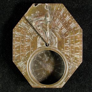
OBJECT HISTORY: Le Maire Sundial
The Le Maire Sundial is a rare example of a mid-18th century French sundial (cadran solaire) compass (boussole). It was found near Green Bay in 1902 by a local antiquities collector, Frank Duchateau.

French Cartography in the Great Lakes
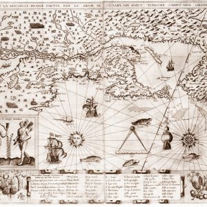
French mariners and explorers using the Le Maire Sundial Compass depended on both their own specialized navigational expertise and maps produced by French cartographers. Many such maps were created based on explorer accounts of the navigable waterways between the Atlantic Ocean to the Mississippi River.

French Wisconsin at Fort la Bay
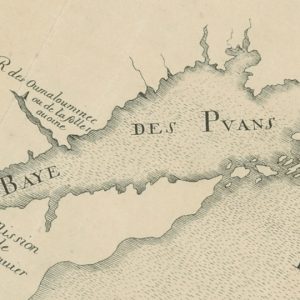
French explorers, voyageurs (fur traders), Jesuit priests, and other settlers began arriving in the Upper Great Lakes region of North America in the mid-1600s. Jean Nicolet supposedly landed near present-day Green Bay, Wisconsin in 1634, naming the waterway La Baye des Puants, literally “Bay of Bad Odors.”